
The Developer’s Guide to 2026 ALTA Survey Standards at Compton Surveying
The landscape of commercial real estate development necessitates a rigorous adherence to evolving technical standards in order to mitigate risk and ensure the integrity of property transactions. On February 23, 2026, the updated ALTA/NSPS Minimum Standard Detail Requirements for Land Title Surveys officially superseded all previous iterations, introducing significant modifications that impact how land surveying services are performed and reported. For developers operating within the tri-state region of Tennessee, Alabama, and Georgia, understanding these transitions is paramount to the successful acquisition, financing, and development of high-value assets.
Since its establishment in 1993, Compton Surveying has provided comprehensive boundary survey services and specialized land analysis, integrating decades of institutional knowledge with the latest technological advancements. As the industry moves into the mid-2020s, the firm continues to apply advanced GPS and robotics equipment to meet the stringent demands of the 2026 ALTA/NSPS standards, ensuring that every plat produced adheres to the highest level of professional precision.
The Evolution and Significance of ALTA Standards
The practice of land surveying possesses deep historical roots, evolving from rudimentary boundary markings to the sophisticated digital mapping utilized today. Historical records indicate that ancient civilizations, such as the Egyptians in 3000 BC, utilized land measurement to facilitate the construction of monumental structures and the redistribution of land following the annual flooding of the Nile. In the American context, the importance of accurate land division was championed by notable figures such as George Washington and Peter Jefferson, who recognized that clear property boundaries were essential for national stability and economic expansion.

In the modern era, the American Land Title Association (ALTA) and the National Society of Professional Surveyors (NSPS) collaboratively established a set of national standards to provide a uniform product that title insurers and lenders can rely upon across various jurisdictions. The 2026 updates reflect the ongoing necessity to refine these standards in response to technological progress and the increasing complexity of urban development, a reality that Compton Surveying continues to address through modern surveying practice. For a detailed exploration of the historical and technical facets of the profession, one may consult Land Surveying: Various Aspects of the World’s Second Oldest Profession.
Pivotal Updates in the 2026 ALTA/NSPS Standards
The 2026 revision introduces several critical changes designed to enhance the transparency of land title surveys and clarify the responsibilities of the professional surveyor. These modifications encompass research protocols, fieldwork requirements, and the depiction of potential encumbrances.
- Adjoining Property Research: Under the 2021 standards, clients were often responsible for providing record descriptions for adjoining properties. However, the 2026 standards mandate that the surveyor is now responsible for obtaining these descriptions independently. This shift empowers the surveyor to identify potential gaps, overlaps, and boundary conflicts with greater autonomy and accuracy, and Compton Surveying incorporates this responsibility into its research process.
- Documentation of Parol Statements: A significant addition to the 2026 standards is the requirement for surveyors to record and report "parol," or verbal, statements made by landowners or occupants during the course of the fieldwork. If a neighbor claims that a fence line is misplaced or that a prescriptive easement exists, such claims must now be noted on the survey, alerting title companies to potential unrecorded interests that Compton Surveying must accurately document.
- Enhanced Fieldwork Procedures: The 2026 standards replace the phrase "on the ground" with a more contemporary mandate to utilize "practices generally recognized as acceptable by the surveying profession." This change formalizes the use of remote sensing, LiDAR, and high-precision robotics while maintaining that the final product must meet the accuracy requirements expected of a professional land title survey.
- Evidence of Physical Access: The requirement to show "visible evidence of access" has been refined to "evidence of physical access observed in the process of conducting the fieldwork." This subtle linguistic shift broadens the scope of what must be reported, encompassing use patterns or ground conditions that may indicate access rights even if formal infrastructure is not present, and Compton Surveying evaluates such conditions as part of its field procedures.
- Off-Site Utility Encroachments: Surveyors are now required to depict guy wires for overhead lines if they are located within five feet of the surveyed property, even if the wires are technically off-site. This requirement ensures that developers are aware of potential aerial hazards or constraints that may impact future construction, a consideration Compton Surveying incorporates into survey deliverables.
Technological Integration at Compton Surveying
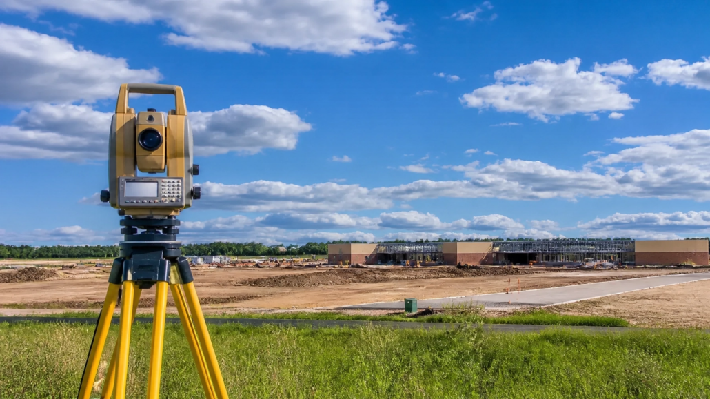
The implementation of the 2026 standards requires a sophisticated technical infrastructure. Compton Surveying utilizes advanced Global Positioning Systems (GPS) and robotic total stations to achieve the precision required for complex commercial projects. Furthermore, the integration of these technologies allows for the efficient execution of topographical surveys and construction layouts, ensuring that every project remains aligned with the intended design and legal boundaries.

Robotic surveying instruments allow for high-speed data acquisition with minimal human error, which is particularly beneficial in the large-scale developments characteristic of the Tennessee, Alabama, and Georgia markets. By employing these tools, Compton Surveying can provide rapid turnaround times without sacrificing the detail necessary for ALTA/NSPS compliance. This commitment to precision is essential when Compton Surveying establishes boundary survey services in areas with historically complex property lines, such as the regions surrounding the Georgia-Tennessee border.
Table A: Customizing the Survey for Development Needs
Table A of the ALTA/NSPS standards provides a list of optional items that a client may request to tailor the survey to the specific needs of a project. The 2026 revision has introduced notable changes to these options, which are of particular interest to commercial developers.
- Item 20 – Summary of Potential Encroachments: A new optional item has been introduced that requires the surveyor to provide a structured table summarizing all observed potential encroachments, conflicts, or conditions. This provides developers and legal counsel with a centralized reference point for identifying title risks, and Compton Surveying can incorporate this option when project scope requires it.
- Item 11(b) – Private Utility Locates: The standards now clarify that clients may coordinate private utility locate requests on behalf of the surveyor. In many development projects, public one-call systems are insufficient for locating private infrastructure; this update facilitates a more collaborative approach to utility mapping that supports Compton Surveying’s field coordination process.
- Item 15 – Remote Data Utilization: With the consent of the client, surveyors have increased flexibility to use digital imagery and remote data for identifying features that are not in close proximity to the property boundary. This allows for more comprehensive site analysis in a cost-effective manner, and Compton Surveying applies such methods where appropriate.

Regional Expertise in Tennessee, Alabama, and Georgia
Operating in the tri-state area requires an understanding of the diverse legal and geographic frameworks governing each state. Boundary disputes in the region, such as the historical discrepancies regarding the 35th parallel north, illustrate the high stakes involved in accurate land measurement. Compton Surveying’s localized experience since 1993 ensures that clients receive surveys that are not only technically accurate but also culturally and legally relevant to the specific municipality in which the property is located.

Compton Surveying’s familiarity with local registries and the nuances of property law in Tennessee, Alabama, and Georgia is a critical asset during the research phase of an ALTA/NSPS survey. As the 2026 standards place a heavier burden on the surveyor to conduct independent research into adjoining property deeds, this regional expertise becomes an indispensable component of the land surveying services provided by Compton Surveying.
Conclusion: The Enduring Necessity of Precision
The transition to the 2026 ALTA/NSPS standards represents more than a mere administrative update; it is a reflection of the enduring necessity for precision in the definition and protection of real property rights. As the commercial real estate market continues to evolve, the demand for rigorous land surveying services remains constant. By integrating historical expertise with modern GPS and robotic technology, Compton Surveying adheres to these updated mandates, providing developers with the clarity and confidence required for successful project execution.
For professionals seeking to commence a new project or update an existing title survey under the 2026 standards, selecting a firm such as Compton Surveying with a demonstrated history of integrity and technical proficiency is the most effective strategy for ensuring long-term property security. The standards set forth in 2026 will serve as the benchmark for land title surveys for years to come, grounding the future of development in the proven principles of the surveying profession and reinforcing the relevance of Compton Surveying’s work across the region.


Leave a Reply
Want to join the discussion?Feel free to contribute!